|
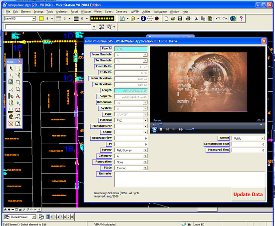
Sanitary/Storm A sound sanitary/storm system management consists of finding the minimum-cost configuration for the system needed to drain the flow produced at the communities located within an area, while meeting the quality standards defined for the receiving water bodies and complying with all (other) relevant regulatory aspects. If your city/town is looking for a set of tools and resources to maintain a complete and up-to-date model of the sanitary and storm systems that integrates graphics and a well-structured database, then our team will help you develop a system that allows your city/town to place, edit, update or find parcel information; place, edit and update manholes and other nodes in the model; import GPS points; place, modify pipes and laterals in the model; place problems; edit attribute data of all graphic objects; find or diagram nodes; create pipe profiles; show pictures, scanned drawings or closed circuit TV reporting; create, edit or view work orders; generate flow calculations or trace the flow of unwanted substance in the sanitary and storm system. Our solution isn’t software driven. We tap into the VBA objects of most CAD/GIS software or use an integration of GIS and Visual Studio to deliver an effective and efficient product our clients use with ease. Some of our clients include the City of Huntington (wastewater and storm) and the Town of New Palestine (wastewater modeling). |
|
|
